
Interactive Map

Zoom and pan to click on points or polygons for more information about available services and supports.

Make map full screen. Full screen is the best way to view the map on mobile devices.

Use buttons to help find services and supports.

Turn on or off layers. Layers consist of local, regional, provincial/territorial, and national network organizations. Local organizations are displayed as pins, while all other organizations are displayed as polygons which represent the primary area being served (upper right corner map).
Open list of national organizations providing services and supports (bottom centre map).
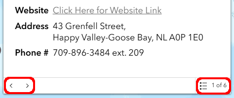
Use the arrows in the bottom left corner of the pop-up window or select from the list in the bottom right corner to access all organizations located at a pin. Services with national/provincial/territorial coverage are "stacked" together within the same boundary.
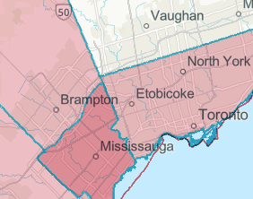
Areas that appear darker in colour are comprised of multiple regional services and supports in the same location.
In exchange for accessing and using trans-LINK Canada Network and the associated, authorized maps and data (the Material) you agree to abide by the requirement to not copy, redistribute, or incorporate the Material into any new or derivative work.